 UKGEOS Data Catalogue
British Geological Survey
Type of resources
Topics
Keywords
Contact for the resource
Provided by
Years
Formats
Representation types
Update frequencies
Service types
-

The initial borehole information pack from the TH0424 Ground Investigation Borehole drilled as part of the UK Geoenergy Observatories (UKGEOS) Cheshire facility. TH0424 was drilled to TD of 101 m between the 08-Nov-2021 and 30-Nov-2021. Drill core was collected from 2 m – 101 mm with 100 mm diameter. This initial data release pack from BGS contains composite and digital wireline logs alongside daily driller's borehole records. This information pack also contains the Initial Core Scan dataset from the BGS Core Scanning Facility (https://doi.org/10.5285/b06d44e6-324d-4e19-bf78-a4520b9b87c8).
-

An additional core scanning dataset from the TH0424 drill core that was drilled onshore at Thornton Science Park, Cheshire, UK as part of the UK Geoenergy Observatories (UKGEOS) Cheshire ground investigation funded by UKRI/NERC. The approximately 100 m long core succession comprises the Sherwood Sandstone Group. This additional core scanning dataset pack contains high-resolution optical images and X-ray fluorescence (XRF) downcore point measurements obtained using a Geotek Core Workstation (MSCL-XYZ) at the Core Scanning Facility (CSF) at the British Geological Survey (BGS).
-

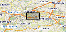
The UK Geoenergy Observatories (UKGEOS) Glasgow baseline surface water chemistry dataset1 released from the BGS comprises an excel file with two spreadsheets. The first spreadsheet contains information on the chemical composition of 98 surface water samples (84 samples and 14 field duplicates) collected monthly for 14 months between February 2019 and March 2020 from six sampling locations. These comprised three on the River Clyde at the UKGEOS Glasgow Cuningar Loop borehole cluster and three from control sites (two on the River Clyde and one on the Tollcross Burn). Field measurements of pH, redox potential, specific electrical conductance, temperature, dissolved oxygen and alkalinity and laboratory chemical data for concentrations of 71 inorganic and 10 organic substances in the surface water samples are presented. The dataset contains locational and descriptive information about the samples also. The analyte name, element chemical symbols, analytical method, units of measurement and long-term limits of detection are recorded in header rows at the top of the spreadsheet. The limits of detection/quantification for each monthly batch of samples are documented in rows at the head of each batch. The dataset includes abbreviations documenting quality control issues such as missing values. A guide to abbreviations used in the dataset is provided in the second excel spreadsheet released with the data. Further details about the dataset can be found in the accompanying report http://nora.nerc.ac.uk/id/eprint/529818.
-

An initial core scanning dataset from the TH0424 borehole that was drilled onshore at Thornton Science Park, Cheshire, UK as part of the UK Geoenergy Observatories (UKGEOS) Cheshire ground investigation funded by UKRI/NERC. The approximately 100 m long core succession comprises the Sherwood Sandstone Group. The core scanning dataset contains X-ray radiographic images and geophysical property data obtained using a Geotek rotating X-ray computed tomography (RXCT) core scanner and a Geotek multi-sensor core logger (MSCL-S) at the Core Scanning Facility (CSF) at the British Geological Survey (BGS).
-

A core scanning dataset from the BHA-101 drill core that was drilled onshore at the Ince Marshes site near the village of Elton, Cheshire, UK as part of the UK Geoenergy Observatories (UKGEOS) Cheshire ground investigation funded by UKRI/NERC. This core scanning dataset pack contains high-resolution optical and radiographic images, X-ray fluorescence (XRF) and physical property downcore point measurements on core from 71.12 m to 121.1 m (Sherwood Sandstone Group) obtained at the Core Scanning Facility (CSF) at the British Geological Survey (BGS).
-

An additional core scanning dataset from the TH0424 drill core that was drilled onshore at Thornton Science Park, Cheshire, UK as part of the UK Geoenergy Observatories (UKGEOS) Cheshire ground investigation funded by UKRI/NERC. The approximately 100 m long core succession comprises the Sherwood Sandstone Group. This additional core scanning dataset pack contains high-resolution optical images and X-ray fluorescence (XRF) downcore point measurements obtained using a Geotek Core Workstation (MSCL-XYZ) at the Core Scanning Facility (CSF) at the British Geological Survey (BGS).
-

This data pack contains information from geotechnical and contaminated land investigations carried out at potential sites for the development of the UK Geoenergy Observatory in Cheshire. Following these investigations, a decision was made to move the proposed observatory to Thornton Science Park. None of the sites discussed in this data pack are in scope for development as part of the Cheshire Observatory. In total 16 holes were drilled using a variety of techniques. The only hole to be drilled using rotary coring was BHA-101. This borehole was cored extensively and logged with wireline geophysical tools. As such this is the main focus of the data pack. BHA-101 was drilled to TD of 121.2 m between 19-Nov-2020 and 09-Dec-2020. Drill core was collected from 51 m – 121 mm with 100 mm diameter. This initial data release pack from BGS contains composite and digital wireline logs alongside daily driller's borehole records.
-
The UK Geoenergy Observatories (UKGEOS) Glasgow 3D coal mine model outputs, created by the British Geological Survey, provide a semi-regional overview of the depth and extent of surveyed and probable coal mine workings, plus stone and coal roads surveyed within the mines. The model allows users to visualise the surveyed and probable coal mine workings to be found beneath this part of Glasgow, applicable at a scale of around 1: 25,000 to 1: 10,000. The data is supplied as grids, triangulated surfaces over a 5 by 4.15 km area, with the depth range to around 300 m below Ordnance Datum. The mine extents are ‘cut out’ of the UKGEOS Glasgow post-drill bedrock model. This model describes both surveyed (recorded on mine abandonment plan) and probable coal mine workings. An area of probable workings has been updated to account for the results of drilling borehole GGC01. Further details and model limitations can be found in the accompanying metadata report http://nora.nerc.ac.uk/id/eprint/531157/
-

The UK Geoenergy Observatories (UKGEOS) Glasgow bedrock model outputs, created by the British Geological Survey, provide a semi-regional overview of the depth and extent of bedrock lithostratigraphic units, coals and faults. The model allows users to visualise the likely subsurface sequence to be found beneath this part of Glasgow, applicable at a scale of around 1: 25,000 to 1: 10,000. The data is supplied as grids, triangulated surfaces and shapefiles over a 5 by 4.15 km area, with the depth range to around 350 m below Ordnance Datum. This model describes an interpretation of the bedrock geology after the UKGEOS Glasgow boreholes had been drilled, the results of the nine UKGEOS boreholes that penetrated bedrock have been incorporated. Further details and model limitations can be found in the accompanying metadata report http://nora.nerc.ac.uk/id/eprint/531157/
-

We collect data from sensors located throughout the UK and beyond capturing information on properties such as groundwater temperature and levels, barometric air pressure and motion sensors. We have recently started collecting information related to the energy efficiency of buildings and have developed techniques for incorporating data from sensors operated by other institutions. Some of the data we collect is available through the sensor API and sensor dashboard which provides easy access to the API data.